Table of Contents
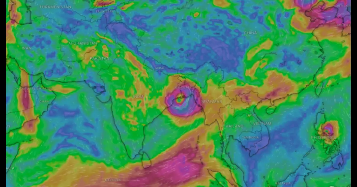
Cyclone Remal is projected to form over the east-central Bay of Bengal in the early morning hours of May 25 and potentially become a severe cyclone by May 26. The storm’s unpredictable nature, particularly concerning its path and landfall, has prompted the India Meteorological Department (IMD) and relevant state government administrations to remain vigilant.
Cyclone Remal’s Formation and Potential Path
Initial Development and Intensification
The IMD has reported that a low-pressure area formed in the south Bay of Bengal is expected to intensify into a depression with wind speeds of 40-50 km/hr by the morning of May 24. This depression may further strengthen into a deep depression (50-60 km/hr) later that day and evolve into a cyclone (60-70 km/hr) by the following morning. The initial movement of the is predicted to be in a northeasterly direction.
Projected Path and Landfall
After forming, Remal is expected to turn northwards, gathering more moisture and increasing its wind speeds. It is likely to reach the coasts of West Bengal and Bangladesh as a severe cyclone with wind speeds of up to 120 km/hr, according to the IMD.
Weather analysis platform Windy.com shows two different potential tracks for Remal based on different datasets. Using data from the European Centre for Medium-Range Weather Forecasts (ECMWF), Windy indicates a northerly route, with the cyclone making landfall along the West Bengal coast and impacting the vulnerable Sundarbans delta on the evening of May 26. Conversely, data from the US Global Forecasting System (GFS) suggest a sharp turn westwards, with landfall expected between Puri and Paradip on the Odisha coast on the morning of May 26.
Factors Influencing Cyclone Remal’s Behavior
Sea Surface Temperatures and Wind Shear
The US Navy’s Joint Typhoon Warning Centre (JTWC) has highlighted the warm sea surface temperatures (30-31°C) and moderate vertical wind shear along the s path, both conducive to its formation and intensification. However, the JTWC has not provided detailed information about the cyclone’s exact track or projected wind speeds.
Divergent Forecast Models
Forecast models have offered varying predictions regarding Remal’s path and intensity. The Weather Channel (TWC) notes that the GFS anticipates a potential escalation into a Severe Cyclonic Storm (SCS) or Very Severe Cyclonic Storm (VSCS) as the heads northwestwards towards eastern India. In contrast, the ECMWF predicts a weaker system, potentially remaining a depression due to upper cold air flows and charting a northward trajectory towards Bangladesh or northeastern India.
Impact and Preparedness
Heavy Rainfall Alerts
The IMD has issued heavy rainfall alerts for West Bengal, Odisha, Mizoram, Tripura, and south Manipur for May 26 and May 27. These regions are advised to prepare for potential severe weather conditions associated with Cyclone Remal.
Monitoring and Response
All national and international weather agencies, particularly the IMD, along with the state administrations of Odisha, West Bengal, and the northeastern states, are closely monitoring the cyclonic system. Their efforts aim to ensure timely and effective responses to any changes in the cyclone’s path and intensity.
TS EAMCET 2024 Results Announced:
Conclusion
Cyclone Remal’s unpredictable nature underscores the importance of robust early warning systems and preparedness measures. As weather agencies continue to monitor the situation, staying informed and ready is crucial for the potentially affected regions. The coming days will be critical in determining the exact impact of Cyclone Remal, and vigilance remains key.
