Table of Contents
Unraveling the Impact: Insights into the Cascadia Earthquake
Scientists are continuously working to better understand the scale and impact of past earthquakes, particularly in regions like the Cascadia Subduction Zone. The most recent significant event in this area, the 1700 Cascadia earthquake, provides a critical case study. By analyzing evidence left behind by the resulting tsunami, researchers can refine their earthquake models and improve predictions for future seismic activity.
Tsunami Deposits as Geological Evidence
The 1700 Cascadia earthquake, which struck the Pacific Northwest coast, left a wealth of geological evidence. This includes sediment cores and sand deposits spread across regions from Northern California to Vancouver Island. Remarkably, even historical records in Japan noted the associated tsunami, further aiding scientists in pinpointing the event to around 9 p.m. on January 26, 1700.
Combining Core Samples with Advanced Modeling
Recent studies have focused on examining sediment cores to estimate the extent of ground subsidence caused by the earthquake. These subsidence estimates are crucial for predicting fault slip in earthquake models. However, a comprehensive approach combining tsunami deposit mapping with sediment transport modeling was lacking—until now.
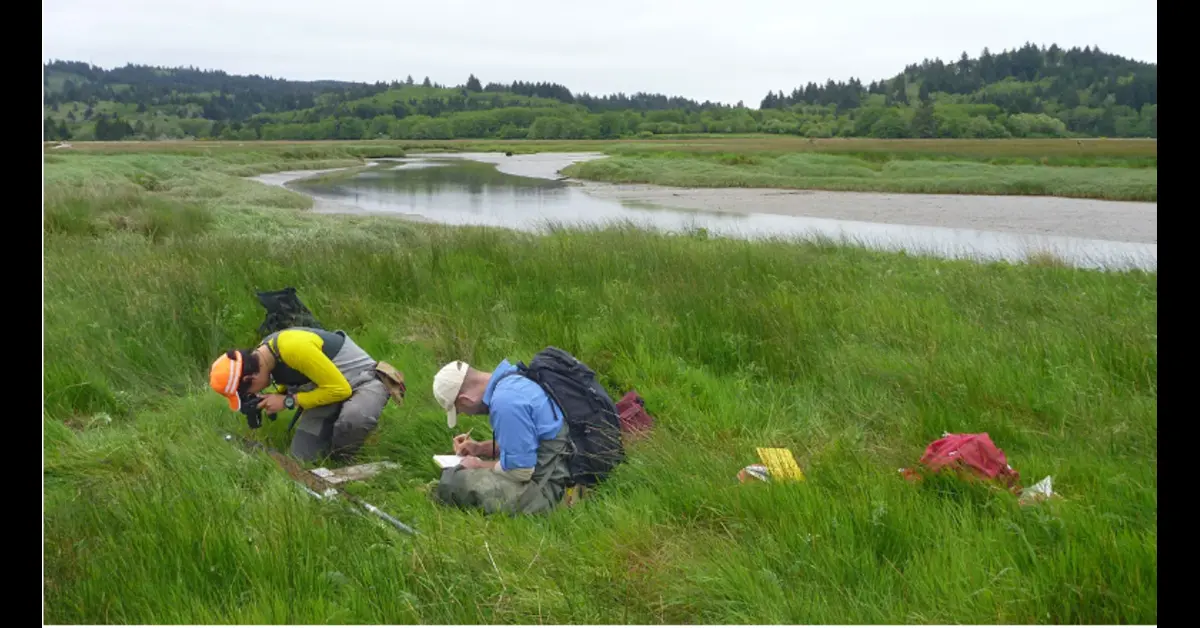
Researchers, including La Selle et al., have taken significant steps to address this gap. By collecting 129 sediment cores from the Salmon River estuary in Oregon and integrating them with 114 existing core logs, they aimed to test the accuracy of various earthquake models. Using the Delft3D-FLOW hydrodynamic and sediment transport model, the team evaluated 15 different models to determine how well each could reproduce the distribution of sediments deposited by the tsunami.
Key Findings and Implications
The findings revealed that to match the observed thickness and extent of tsunami sediments, the 1700 Cascadia earthquake likely caused at least 0.8 meters of subsidence at the Salmon River and about 12 meters of fault slip. Seven of the tested models successfully replicated these conditions at low tide, aligning with the known timing of the earthquake.
This study offers new constraints on the size and character of the 1700 Cascadia earthquake. It also highlights the potential of combining tsunami deposit mapping with sediment transport models to enhance our understanding of past earthquakes and related tsunamis. These insights are invaluable for improving the accuracy of future earthquake predictions.
Future Directions in Earthquake Research
The research underscores the sensitivity of models to factors such as tide level, sand grain size, and sediment transport coefficients. This knowledge will help refine future models of the Cascadia earthquake and other significant seismic events. Further research involving more extensive data collection, testing a broader range of earthquake sources, and comparing different sediment transport and hydrodynamic models is essential for uncovering additional details about past and potential future earthquakes.
William H Dutton: Stop Demonizing Social Media 2024
By continuing to study the sands left behind by tsunamis, scientists can piece together a more accurate picture of historical seismic events. This, in turn, provides crucial insights that can help mitigate the impact of future earthquakes in the Cascadia region and beyond.
